

Toronto Startup Makes Geography Fun Using Augmented Reality
 For many kids, geography class is more humdrum than exciting.
But a new Toronto startup is looking to change that.
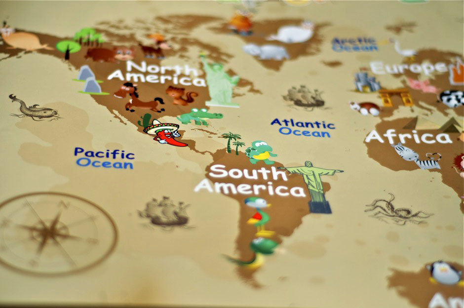
Fun Maps for Kids promises to help Canadian children learn more about the world using digitized, interactive maps. The startup was created by a Toronto family who had just returned from a round-the-world trip with their three-year-old son. Inspired by their travels, Martin Pietrzak and Natasza Cieplik founded the company in 2012 to help their son learn more about international locales.
The startup specializes in print maps, but they aren’t the kind you might find in a run-of-the-mill textbook. Creators Pietrzak and Cieplik wanted to do something more creative and interactive with their products. Their maps use the patented Layar app, which brings static print pages to life using AR technology.
With the map mounted on the wall, children can hold up an iPad equipped with Layar to launch pictures, audio clips, and animations using the touchscreen. A video on the company’s website suggests that the augmented reality maps provide children with a “window to the world.”
In a statement, Martin Pietrzak highlighted the potential of technology to make learning more engaging for Canadian children. “Our aim is to inspire children to learn geography in a fun, exciting and interactive way,” he said. “We want to offer more than just maps for kids; we want to offer interactive educational tools.”
As for Layar, it’s been experiencing something of a boon lately in Canadian media. Reader’s Digest recently used Layar to animate the cover of their magazine. Western Canada’s Glacier Media Group also announced plans to incorporate Layar into their newspapers throughout British Columbia. With a readership of over half a million, Glacier is poised to increase the visibility of AR technology in mainstream media. The accompanying press release calls Canadian newspapers “a proven market for Layar and interactive print.”
Quintin Schevernels, CEO of Layar, pointed out the opportunity for Canadian companies to enrich print media using mobile technology. “Fun Maps for Kids is a very nice interactive print use case where kids can access additional information by using a smartphone or tablet,” he said in a statement. “As children are born into a digital age with smartphones and tablets, there is great potential for interactive print in education.
Given the proven track record of children’s apps in Canada, it’s likely we’ll see more products like Fun Maps for Kids in the future. It may seem surprising, but children are actually some of the biggest users of mobile products. According to a recent Maclean’s article, it’s more likely that pre-school children throughout the world can play an app than tie their shoes.
In 2011, Kids Industries reported that parents surveyed in the US and the UK purchased one app every 12 days for their children. The popularity of apps for kids reflects the demand for interactive, user-driven mobile products that should continue to grow over the next decade.


